Air-Space-Ground Synergy Command&Control Solutions
It realizes the unified scheduling and data aggregation of the patrol tasks of multiple UAVs

Remote Command

One Key Control

Multistage Tandem

Smart Seats,Unified Scheduling
Command Center Characteristics
Remote command & control center is composed of the data server, video server, multitasking control software, analysis of intelligent information processing, management, scheduling control, and mobile command center, to realize the remote control of UAV and pod, real-time processing of front-end information judgment, scheduling and control, make the application of the UAV into the daily management process, ultimately, the unified scheduling and data collection of patrol tasks of multiple UAVs could be realized.

Real-time surveillance of UAV
5G/4G HD Graphics

Reserved professional band communication
Multi-drone scheduling management command

Front-end data quick returning
Remote control operational pod

Automatic AI analysis of big data
Remotely controlled drone flight
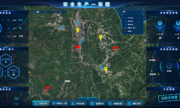
Police & Fire Control
A map of safe production: including visualization of dangerous enterprise, two key and one major, non-coal mine, fireworks and other dangerous information
Forest fire prevention basic information, image resources, monitoring data, risk situation one map visible
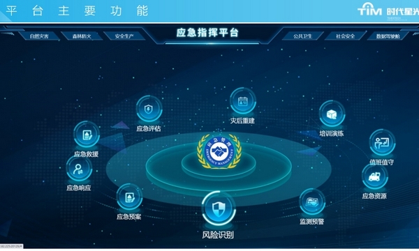
Emergency Rescue
A map of natural disasters: Break through departmental barriers, realize data sharing, and effectively dispatch resources and personnel.
Horizontal access to emergency Management Bureau, Natural Resources Bureau, Water Bureau, Meteorological Bureau, housing Bureau, a total of 5 departments; It involves four categories of data, including risk and hidden danger data, iot sensing data, emergency resource data and carrier data, which are displayed and analyzed in real time.
Emergency shift management, emergency duty management, emergency duty briefing, emergency report management, information release management
Emergency materials management (warehouse management, classification, visualization), emergency resources management (coordinated units, coordinated resources, special support)
Smart City Transportation
Background situation supervision
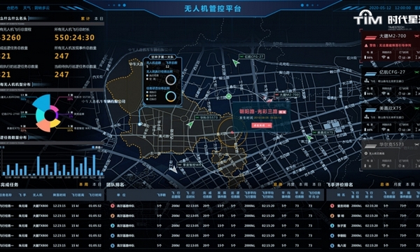
Real-time monitoring of UAV flight status and the current status of the apron, real-time tracking of the task execution progress, so as to facilitate the command center to monitor the UAV flight situation in real time.
The mobile terminal of UAV mobile phone APP can provide real-time video, overview of patrol tasks and overview of flight tasks of the current UAV, and realize panoramic dynamic real-time tracking anytime and anywhere.
Freeway cruise scene identification
Model recognition, parking event alarm, congestion event alarm, vehicle flow, density calculation, real-time analysis results and data AI analysis.
Spot scene identification of intersection section
Traffic statistics at fixed points of urban intersection sections, such as traffic survey at peak times, real-time analysis results and data AI judgment.
