TIM-UT200
Strong empowerment for the integration of open space

Ergonomic Design

HD 10 inch 1920*1080

Bright industrial touch display 1000cd/㎡

5 hours of battery life

Dust-proof design

Rainproof design

Mission Pod Integrated Control

Remote control and flight control
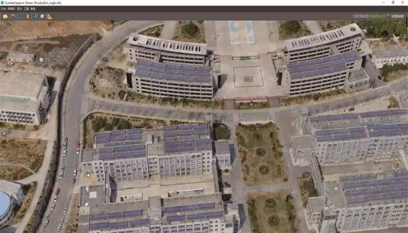
3D modeling software
Using complex photogrammetry, computer vision and computer geometric algorithms and other technologies, only relying on a set of standards, continuous oblique aerial photography and close-up photography collected on the ground can automatically build a fine-structured three-dimensional grid model, realizing urbanization. Full element modeling of buildings, trees, roads, walls. It has the characteristics of authenticity, measurability, and fast speed, which can realize rapid restoration of various business scenarios of smart cities.
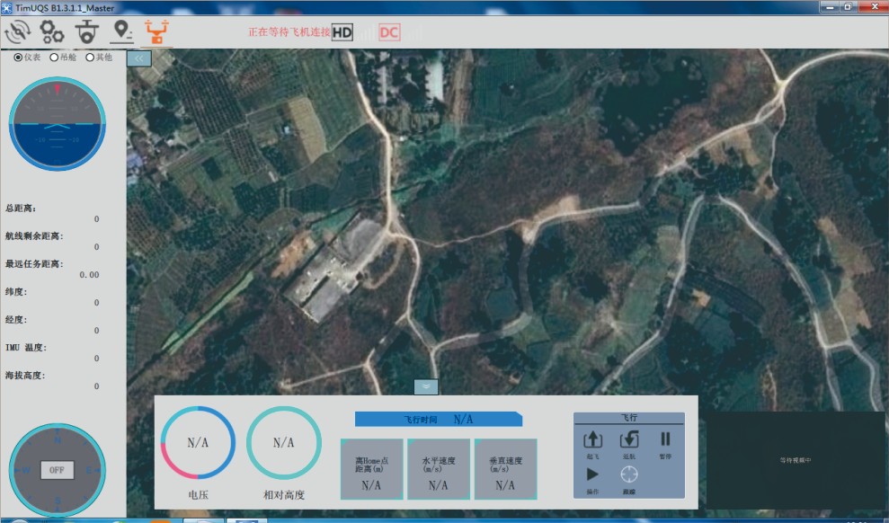
Ground station integrated management software
The ground comprehensive management software is a ground receiving display and management platform software developed for the UAV image transmission system. The system realizes real-time UAV image access display, flight attitude monitoring, route planning, flight speed monitoring, real-time display of flight trajectory, and real-time display of various UAV attitude data: altitude, speed, power, wireless signal strength, etc. In addition to realizing real-time control of the aircraft, it can also control various functional pods such as photoelectric, throwing, shouting, and poisonous gas. It is powerful, safe and reliable. Can be widely used in public security, fire protection, transportation, electric power, energy and other industries
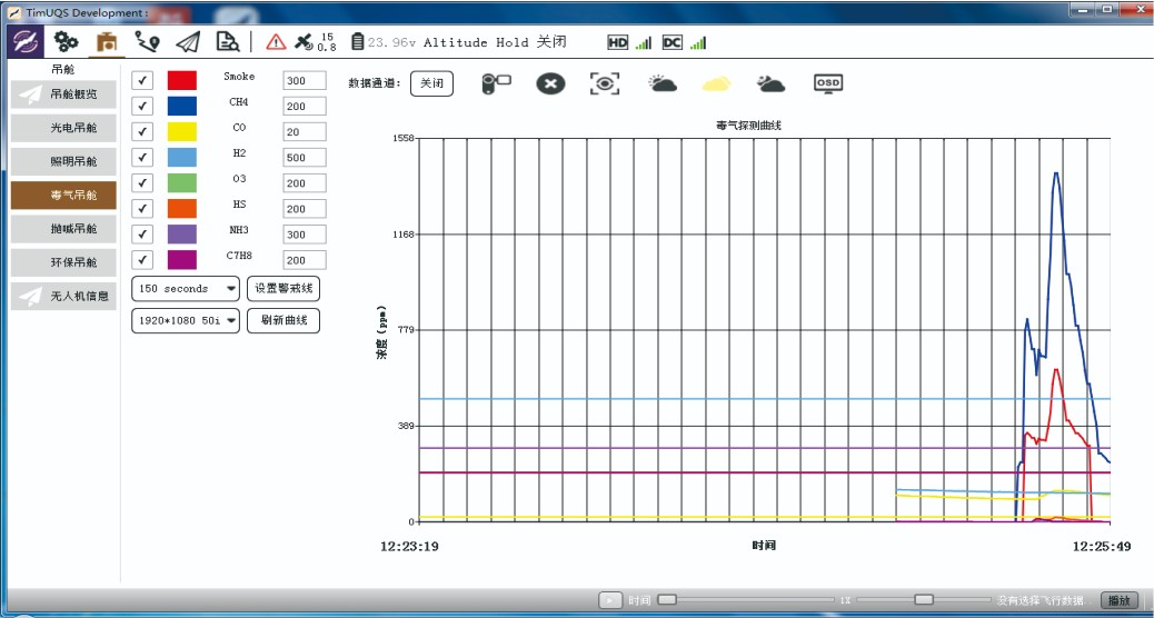
Gas data analysis software
Real-time analysis of the detection data wirelessly transmitted from the front-end poison gas detection pod of the UAV. It is visually displayed to the detectors in the form of graphs and curves, helping them to quickly grasp the actual detection results of 8 common toxic gases, and support automatic marking of areas exceeding the standard, providing a scientific basis for decision-making.
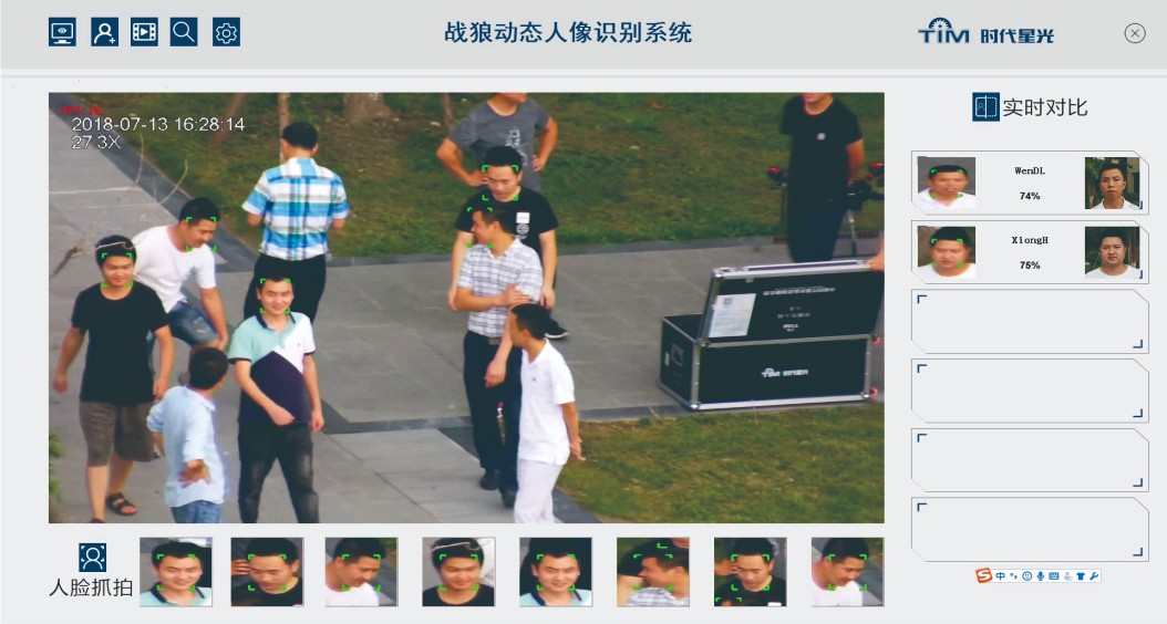
face recognition software
The portrait dynamic recognition system is a professional product used for drone aerial remote dynamic identification of portraits. The recognition algorithm is developed based on the deep learning platform, and uses intelligent detection technologies such as face detection, tracking, and face recognition to perform real-time face recognition analysis on people. Provides an aerial panoramic view. The panoramic data synthesis algorithm is advanced, the synthesis effect is good, the processing speed is fast, and the results are output in 3 minutes, which meets the requirements of rapid map production on the emergency scene.
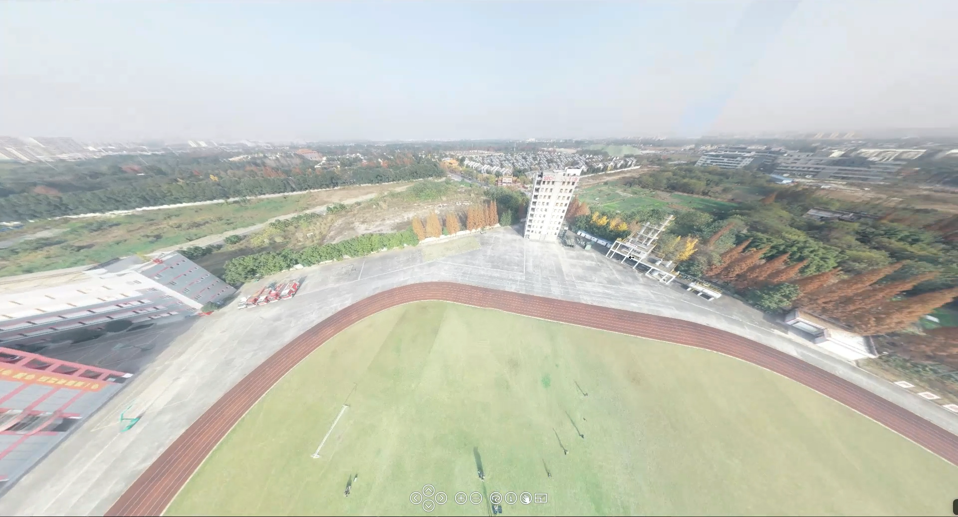
360° Panorama software
Use drones to plan and deploy low-altitude (50-200m) aerial surveys and panorama shooting in the target area, and obtain high-definition aerial photos. With one-click operation, these high-definition aerial photos can be quickly made into 360° The aerial panorama that rotates and supports free zooming provides an aerial panoramic view for on-site emergency commanders
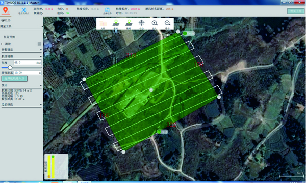
route planning function
Realize the trajectory planning of UAV automatic task execution, can use a variety of templates to quickly complete the task demand planning, or manually and autonomously plan the route, with 718 waypoints
Timestech Cloud UAV control platform
TimCloud 2.0
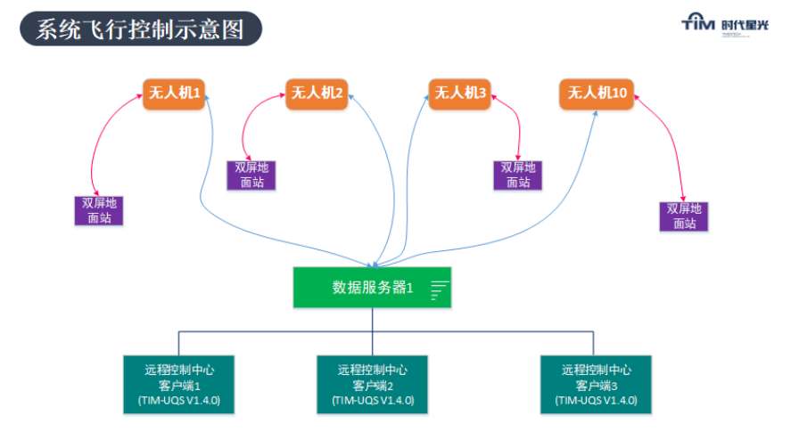
Through the timestech cloud management and control platform, UAV cluster control could be realized
Remote deployment of multiple ground stations and multiple command centers
UAV access, control switch, arbitrary authorization, etc
The Wolf Eye series pod meets the needs of a variety of industries
One drone for multi-applications, small size with big action
Standard pod interface, plug and play, automatic identification of pod types they are the field "scout", real-time "monitor", 3D "modeler", communication "microphone", air "Courier", night "light" and so on, to provide a full range of industrial UAV application solutions.

