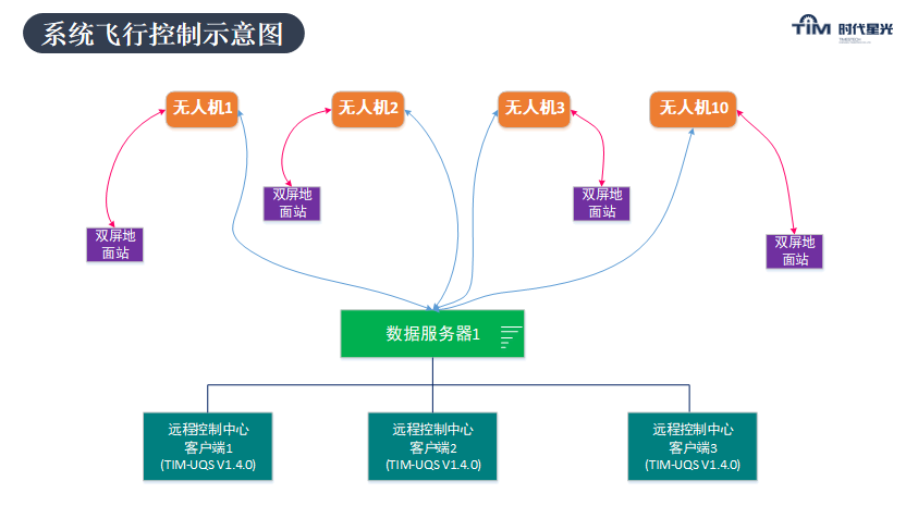
TimCloud UAV management and control platform is a monitoring and control platform for UAVs launched in view of the problems existing in monitoring and communication of UAVs in my country under the background that the country encourages the development of the general aviation industry and the promotion and application of the Beidou navigation system. product.
The system not only realizes the rapid positioning of the UAV, but also realizes two-way communication between the ground command center and the UAV. It plays an important role for the command department to grasp the airspace dynamics in time and ensure flight safety.
It can also remotely realize the access and display of multiple drones, planning tasks, and manual authorization of control rights. Through the time cloud management and control platform, UAV cluster control, UAV access, control switching, arbitrary authorization, etc.
The secret weapon of the Wolf Warrior drone all-rounder, we also have
Fine 3D modeling software
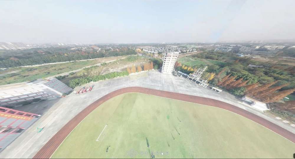
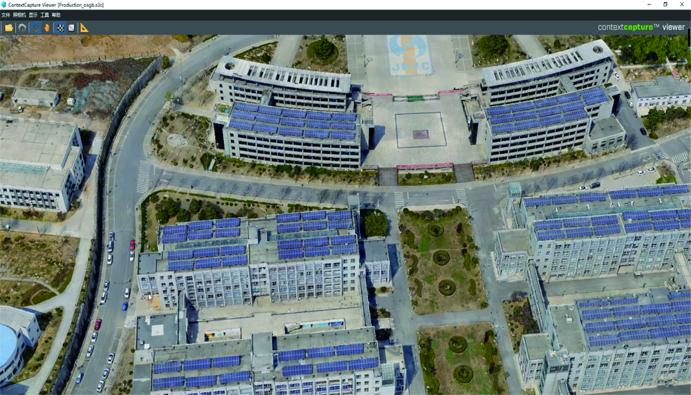
Using complex photogrammetry, computer vision and computer geometric algorithms and other technologies, only relying on a set of standard, continuous tilt aerial cameras to collect close-up photography on the ground, a fine-structured 3D mesh model can be automatically constructed to achieve Full element modeling of city buildings, trees, roads, and walls. It has the characteristics of authenticity, measurability, and fast speed, which can realize rapid restoration of various business scenarios of smart cities.
Rapid 3D modeling software
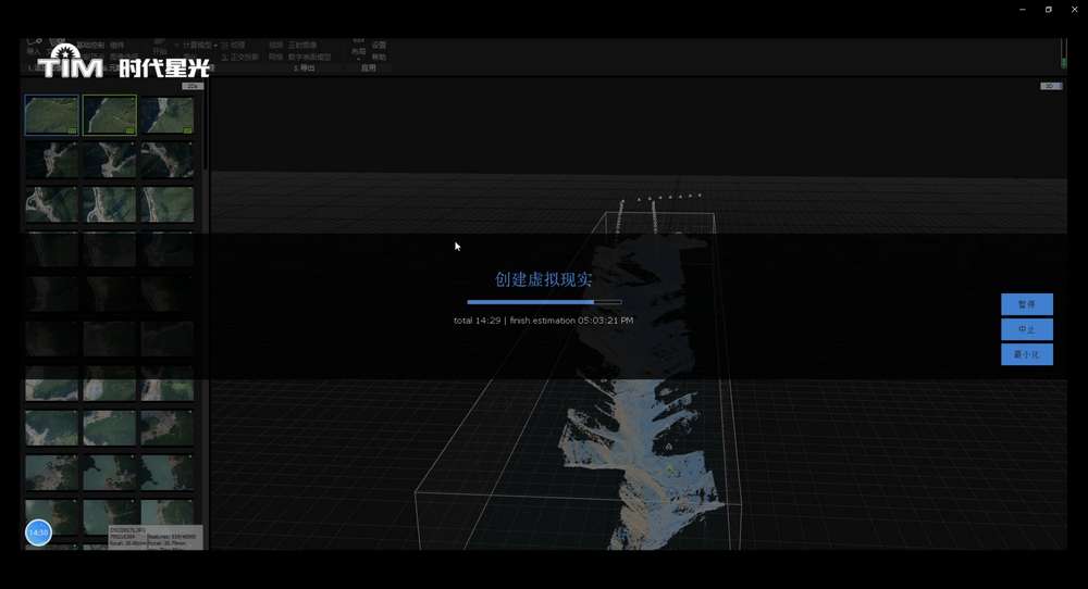
Rapid 3D modeling software is an advanced all-in-one photogrammetry, 3D modeling application that automatically extracts realistic and accurate 3D models from a set of common images or laser scan data. The implementation speed is extremely fast, it can be automatically completed in just a few minutes, and the work completed by other products in a few days can be completed in minutes. It is widely used in various occasions that require rapid modeling and drawing.
Ground station integrated management software
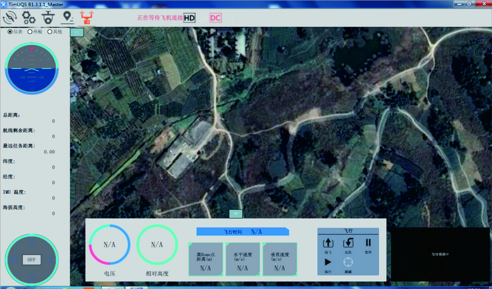
The ground comprehensive management software is a ground receiving display and management platform software developed for the UAV image transmission system. The system realizes UAV real-time image access display, flight attitude monitoring, route planning, flight speed monitoring, and real-time display of flight trajectory. Data: altitude, speed, battery, wireless signal strength, etc. In addition to realizing real-time control of flight control, it can also control various functional pods such as optoelectronics, throwing, shouting, and poisonous gas. The system software is powerful, safe and stable, and can be widely used in public security, fire protection, transportation, electricity, energy and other industries.
Gas data analysis software
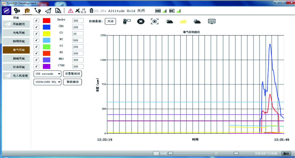
Real-time analysis of the detection data wirelessly transmitted by the UAV front-end poison gas detection pod, and intuitively displayed to users in the form of graphs and curves, to help them quickly grasp the actual detection results of 8 common poisonous gases, and to provide scientific decision-making in accordance with. The collected data is displayed in the form of graphs and curves, and it supports automatic color marking of areas exceeding the standard on the map.
face recognition software
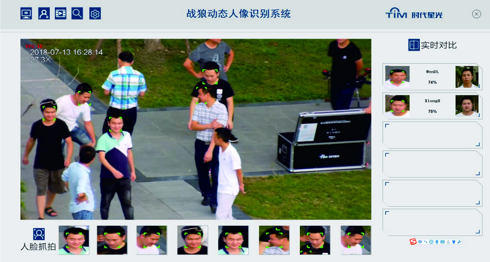
The portrait dynamic recognition system is a professional product used for drone aerial remote dynamic identification of portraits. The recognition algorithm is developed based on the deep learning platform, and uses intelligent detection technologies such as face detection, tracking, and face recognition to perform real-time face recognition analysis on people. Provides an aerial panoramic view. The panoramic data synthesis algorithm is advanced, the synthesis effect is good, and the processing speed is fast, and the result is output in 3 minutes. Meet the requirements of rapid map drawing at the emergency scene.
360° panorama software
The software can generate high-quality 360-degree panoramas with one click, and 360-degree panoramas can be combined by simple original pictures. One-click operation method, the whole process does not require manual intervention, and can quickly complete panoramic synthesis.